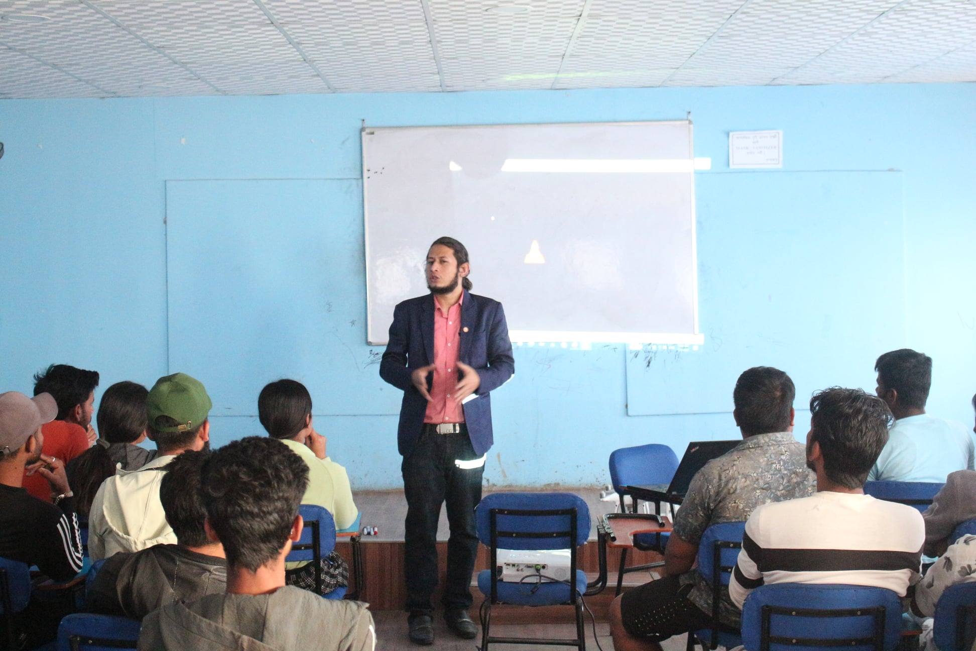
In a groundbreaking move towards bolstering disaster preparedness and response efforts, the Institute of Himalayan Risk Reduction (IHRR) has embarked on its much-anticipated Disaster Academy Initiative. The initiative, aimed at fostering a new generation of adept disaster management professionals, kicked off with Orientation and Sensitization training sessions tailored for final-year students from various Engineering colleges nestled within the Kathmandu Valley.
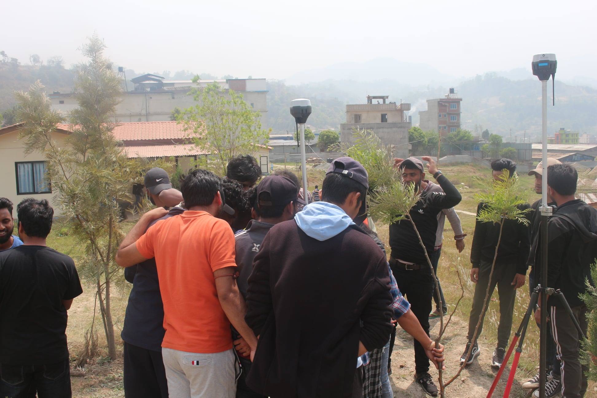
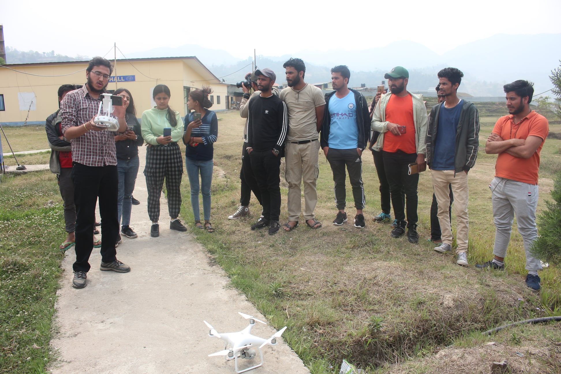
During these comprehensive training sessions, participants are being equipped with essential skills in Spatial data collection tools, including the utilization of DGPS and Drones. These technologies are pivotal in accurately gathering geodata, thereby enhancing the efficacy of disaster risk reduction and management strategies.
A crucial aspect of this initiative is the strategic partnership forged with Geovation Nepal, serving as the technological backbone for the program. Their expertise and support are instrumental in ensuring the seamless integration of cutting-edge technologies into the training curriculum, empowering participants with practical knowledge and hands-on experience.
The collaborative efforts extended by Cosmos College of Management and Technology are also acknowledged with gratitude. Their commitment to fostering innovation and excellence in education has paved the way for this impactful collaboration, amplifying the reach and effectiveness of the Disaster Academy Initiative.
Science Based DRRM, Data for DRRM, Technology in DRR, Local Capacity Building, and Train Our Youths emerge as the guiding principles driving this transformative endeavor. By investing in the education and training of future leaders in disaster management, IHRR remains steadfast in its mission to fortify local communities against the ever-present threat of natural disasters.
As the Orientation and Sensitization training sessions progress, anticipation mounts for the tangible contributions these aspiring engineers will make towards building resilient societies and safeguarding lives and livelihoods in the face of adversity. IHRR's commitment to excellence and innovation in disaster risk reduction shines brightly through initiatives like the Disaster Academy, illuminating a path towards a safer and more secure future for all.
The course of this training specially gave insights on the introduction of Unmanned Aerial Vehicle (UAV) and Differential Global Positioning System (DGPS). The objectives met during the demonstration are:
• Briefing on training contents - Introduction to UAV Surveying, Reconnaissance Survey, Flight - Planning, Ground Control Points setup, data capture
• Basics on Demonstration of DJI Phantom Drone (Hardware) (1 hour)
• Overview of the Drone, components, Drone Assembling
• Basics on Demonstration of Flight Planning [Software] (1 hour)
• Components of Flight Planning
• Things to be considered while planning the flight
• Geo-referencing
• Demonstration of Planned Flight (15 mins)