Project Details
Past
Duration
Aug 01, 2022
– Sep 30, 2022
Client
Cordaid
Location
Aalital Municipality, Dadeldhura
Province
Sudurpashchim
Project Images
4 photos
Project Detail
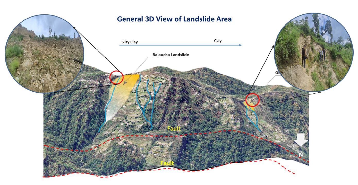
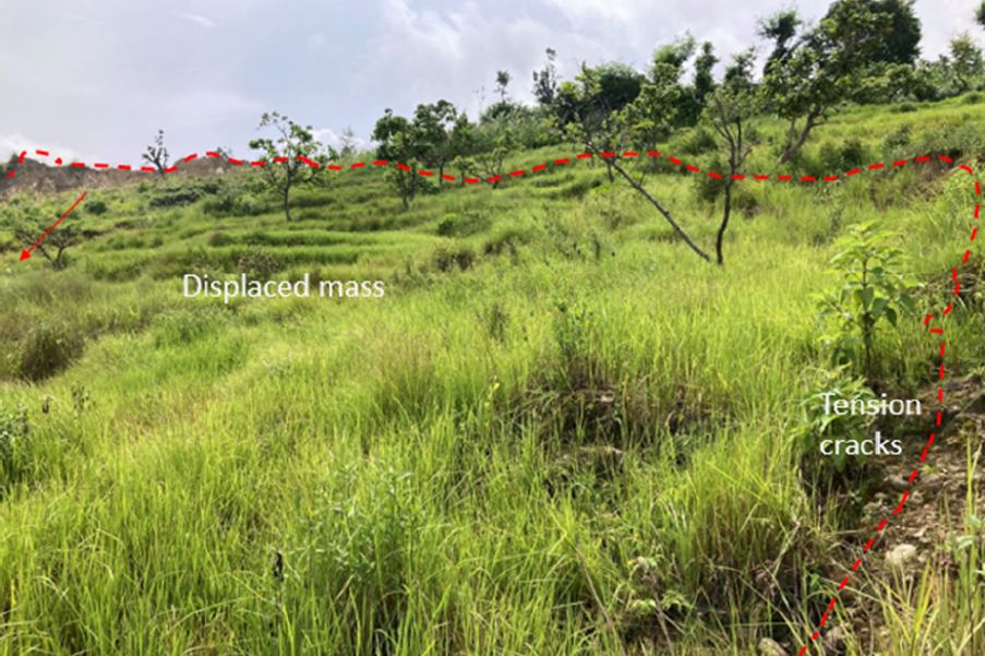
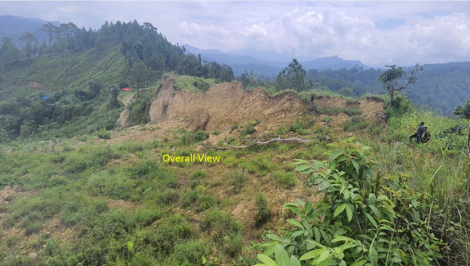
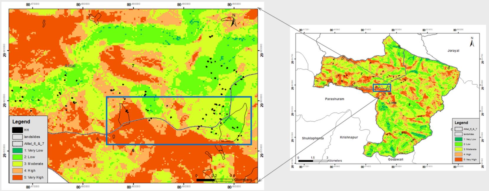
This project has been implemented to assess landslide risks and contribute to community resilience. It involved the development of landslide susceptibility maps, conducting thorough household vulnerability surveys, and deploying drones to map the Balaucha area. With a commitment to adherence to NDRRMA guidelines, this initiative was poised to significantly enhance disaster preparedness and risk management in vulnerable regions.
Major work performed in this project are:
- Developed landslide susceptibility maps in the region.
- Conducted household vulnerability surveys and collection of data.
- Deployed the drones and map of the different areas of Balaucha area and generate high-resolution outputs.
- Computed the Household Level Vulnerability Assessment and risk visualization.
- Submitted the final report and also work on the assessment format as per the NDRRMA guidelines.