Project Details
Past
Duration
Nov 01, 2022
– Dec 31, 2022
Client
Home Net Nepal
Location
Shankharapur Municipality
Province
Bagmati
Project Images
1 photos
Project Detail
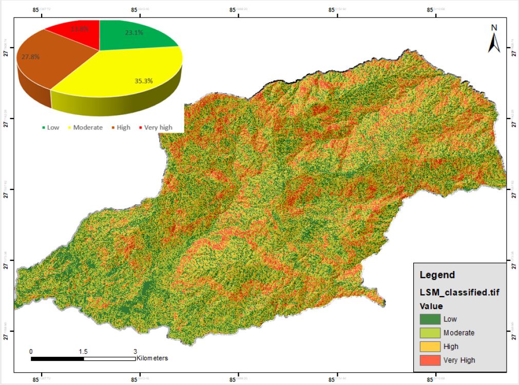
A project in Shankarapur municipality addressed landslide risks by preparing inventory, coordinating data collection, modeling susceptibility, and deriving rainfall thresholds.
Key objectives of the project are:
- To prepare detailed landslide inventory.
- To coordinate with local government to collect available RS and DEM data of Shankarapur municipality.
- To identify landslide conditioning factors and prepare LSM.
- To develop landslide susceptibility model.
- Derivation of rainfall threshold for landslides to trigger