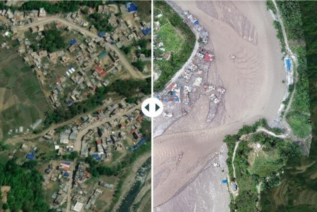
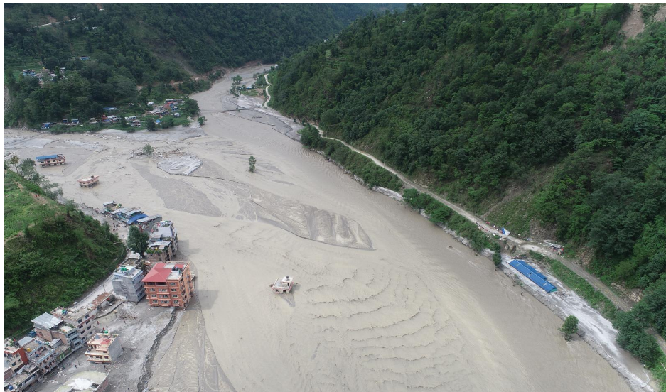
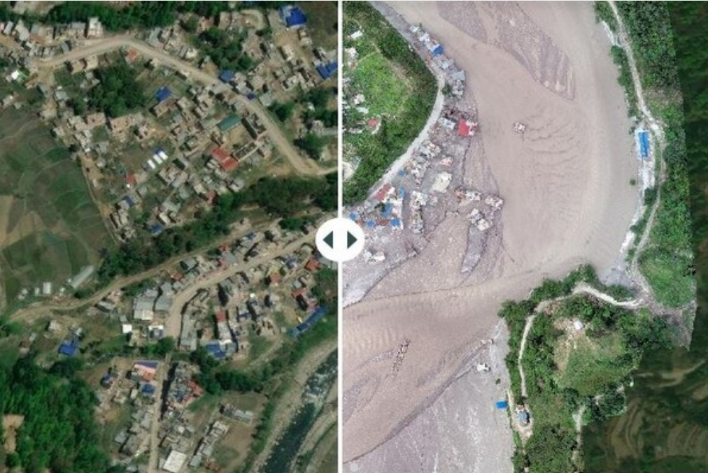
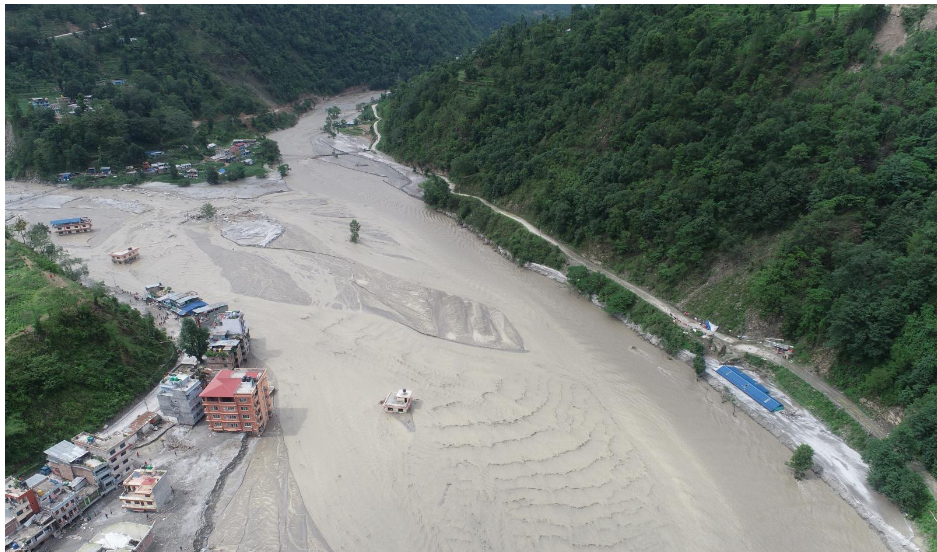
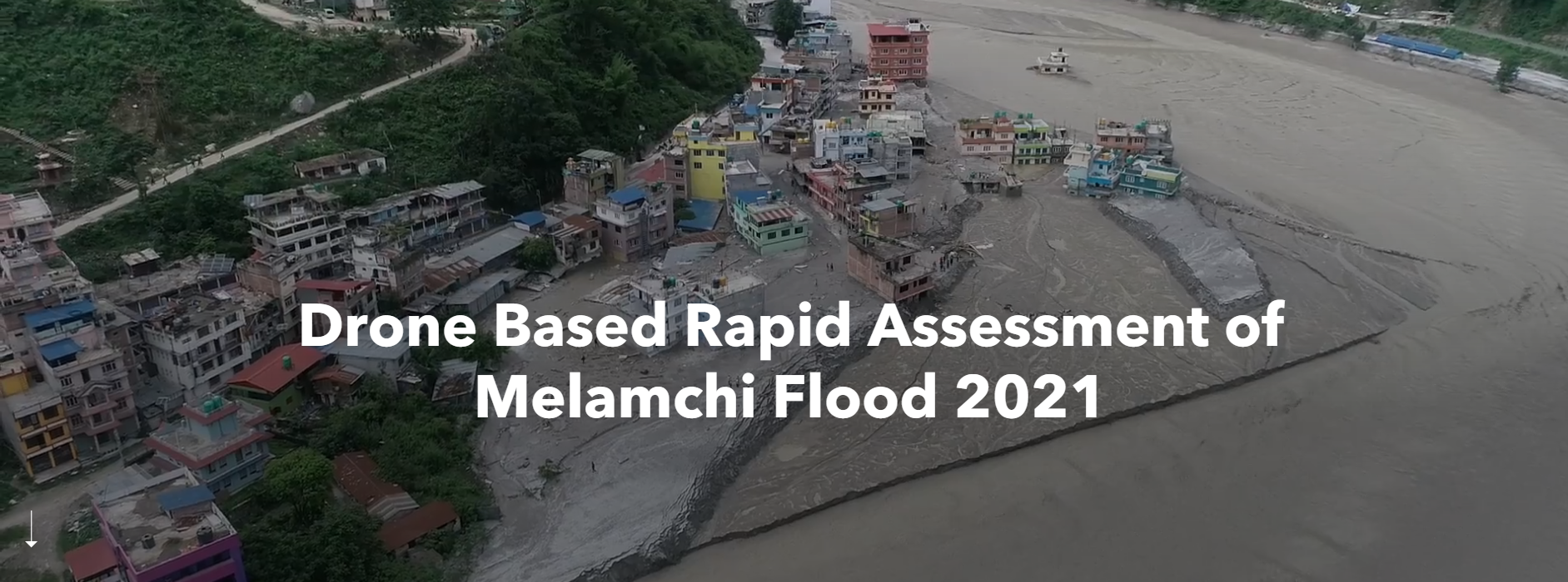
The occurrences of natural hazards are inevitable in the Nepal Himalaya due to active tectonics and strong monsoon. These hazards are turned into disasters claiming lives and destroying properties. The Melamchi Flood is one the recent extreme disasters that occurred in the late night of June 15. The debris flow hit the Melamchi Bazaar and destroyed a number of houses, infrastructure along the road corridor. This debris flood partly destroyed the Headworks of the Melamchi Water supply project.
Immediately after the Melamchi Flood, Sinchupalchowk, our team of drone pilots and Disaster Risk Reduction and Management (DRRM) experts were deployed to the flooding area to obtain first-hand situational ground information for rapid visual damage assessment. On the following day, our team moved to conduct an aerial inspection particularly in the headworks area. Complying with the Standard Operation Procedures (SOPs), National Drone Operational Guidelines and the Humanitarian Unmanned Aerial Vehicle (UAV) Code of Conduct, flight missions were planned as the team prepared for the field. The team took off from Amathang, a nearby settlement 2 km from the headworks area, capturing high resolution images of the catastrophe. Further, deskwork was carried out to generate the required for the project.
To explore more, click here https://storymaps.arcgis.com/stories/5df39824b5604c80be8dfc429be93cfa to view our story map.