Past

Risk and Hazard mapping (including flood risk mapping study of major watershed)-3 Rivers/tributaries

The project involved reviewing existing hydro-meteorological data, establishing flood hazard baselines, mapping flood risks along Melamchi and Indrawati rivers, and assessing vulnerable areas in the Melamchi watershed.

Project Details Past
Duration Feb 01, 2023 – Apr 30, 2023
Client Practical Action
Location Melamchi & Helambu Municipality, Sindhupalchowk
Province Bagmati
Project Images 3 photos
Risk and Hazard mapping (including flood risk mapping study of major watershed)-3 Rivers/tributaries
Project Detail

The project mainly focused to bolster flood preparedness and improve response strategies for the region.

Key tasks performed in the project are:

  • Asses and review of existing hydro and meteorological station and data in the area.
  • Setting up the hydro-meteorological baseline for the flood hazard to model.
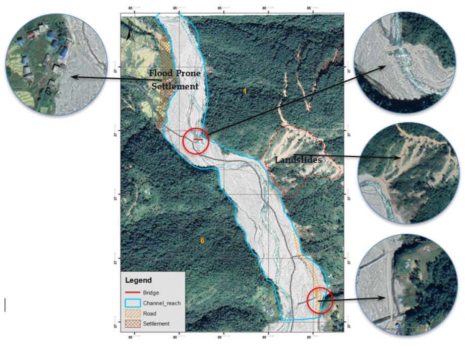
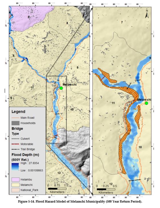
  • Flood hazard mapping of Melamchi and Indrawati rivers.

Assess flood vulnerable area of Melamchi watershed.

All Projects